Betenson Flat
1945
1999
Description:
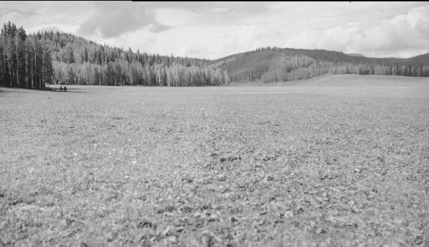
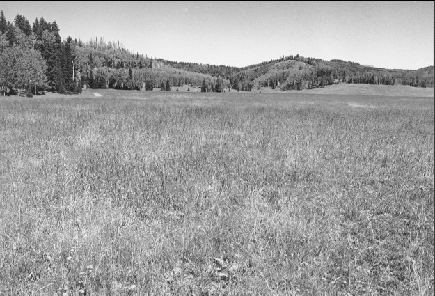
Plate 129 BETENSON FLAT: 1945 - 1999 Plates 127-142 are all of the same general area on the west-central portion of Betenson Flat (a.k.a. Dry Flat). An experimental plot was established in the fall of 1942 on which half of the area was plowed and seeded to smooth brome (Bromus inermis), timothy (Phleum pratense), tall oats (Arrhenatherum elatius), and orchard grass (Dactylis glomerata), and the other half neither plowed nor seeded. Later the entire flat was plowed or seeded. A stock pond is in the flat and cattle continue to use the area. In 1999, timothy and smooth brome remain the most common species that were seeded. This 1945 photo is a view north-northeast before this portion of the flat was treated. The distant hills in the 1999 photo reflect the burn pattern from the 1958 Betenson Flat wildfire.
Photo Information:
1945 photo #465365 taken in September by the U.S. Forest Service; 1999 photo taken by Kay #4496-29 on Sept. 7. Forest Service photo held by the Beaver Ranger District, Fishlake National Forest, Beaver, UT
Vegetative Community:
Dry Meadow, Aspen, Conifer
Location:
South Central: Beaver Mountain, Fishlake National Forest, Beaver Ranger District; T30S, R5W, Sect. 1, UTM ~423170 N, ~380200 E; elevation 9,680 ft., viewed to north-northeast.