Betenson Flat
1945
1999
Description:
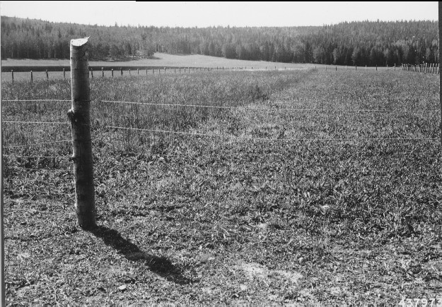
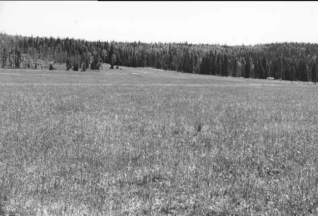
Plate 140 BETENSON FLAT: 1945 - 1999 Plates 127-142 are all of the same general area on the west-central portion of Betenson Flat (a.k.a. Dry Flat). An experimental plot was established in the fall of 1942 on which half of the area was plowed and seeded to smooth brome (Bromus inermis), timothy (Phleum pratense), tall oats (Arrhenatherum elatius), and orchard grass (Dactylis glomerata), and the other half neither plowed nor seeded. The 1945 photo is viewed over the experimental plot established two years earlier in 1942. The area on the left had been plowed and seeded while the site on the right had not. Sometime later the fence was removed and the untreated area seeded, as well as the rest of the flat. A stock pond is in the flat and cattle continue to use the area. In 1999, timothy and smooth brome remain the most common species that were seeded. The trees in the 1999 photo were killed by the 1996 Pole Creek wildfire and subsequently salvage-logged.
Photo Information:
1945 photo #439973 taken Sept. 1 by the U.S. Forest Service; 1999 photo taken by Kay #4500-21 on Sept. 7 Forest Service photo held by the Beaver Ranger District, Fishlake National Forest, Beaver, UT
Vegetative Community:
Dry Meadow, Aspen, Conifer
Location:
South Central: Beaver Mountain, Fishlake National Forest, Beaver Ranger District; T30S, R5W, Sect. 1, UTM ~423170 N, ~380200 E; elevation 9,680 ft., viewed to south.