Below Moroni Peak
1916
2000
Description:
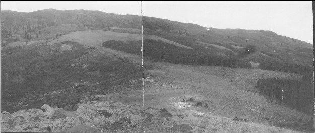
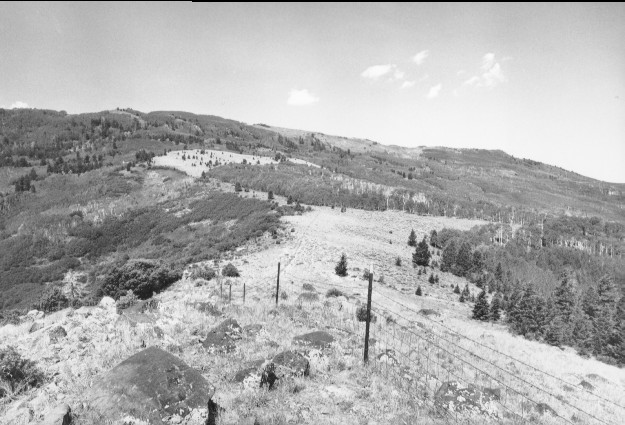
Plate 180. BELOW MORONI PEAK 1916-2000 Plates 180-182 form a panorama from the southwest to the northeast below Moroni Peak. Plate 180 is viewed southwest to Moroni Peak along the ridge between Tommy Hollow (photo left) and Pine Creek (photo right). Aspen has increased in height but has not regenerated due to repeated herbivory by elk, mule deer, and cattle. Douglas fir has increased as has pinyon-juniper. Oakbrush and curlleaf mountain mahogany are the other tall, dark-colored shrubs. An allotment fence has been added.
Photo Information:
U.S. Forest Service photo (unnumbered) taken in 1916; retake by Charles E. Kay on July 26, 2000 - - Photo No. 4634-2; Original photo held by the Forest Service Regional Office Photographic Collection housed at Weber State University, Ogden, UT.
Vegetative Community:
Aspen, Oakbrush, Mountain Brush
Location:
South Central: Section 36, Range 3 E, Township 23 S; UTM 454750 E, 4290800 N; elevation 8,728 ft.