Barney Top
ca. 1930
2002
Description:
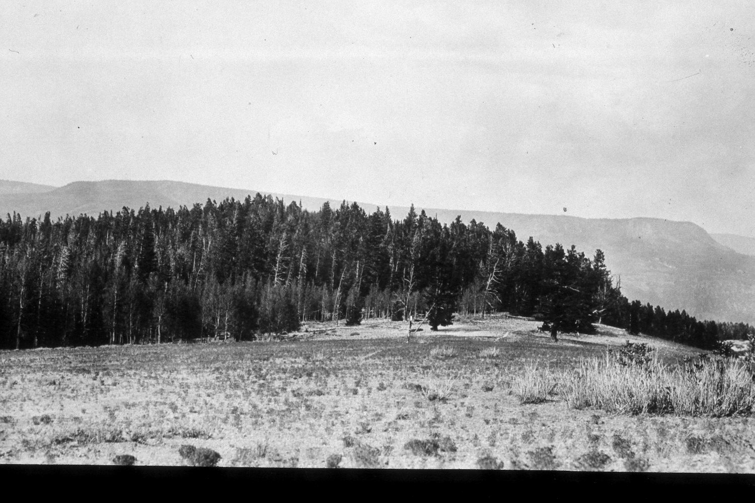
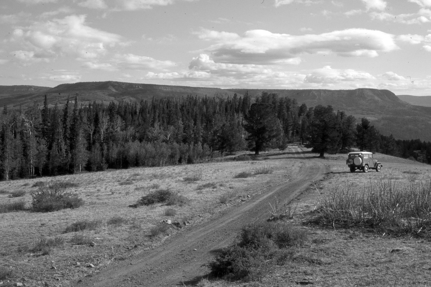
Plate 105X. Barney Top ca. 1930-2002 Viewed north-northeast from the northern end of Barney Top. In the distance are Griffin Top and the Aquarius Plateau. Plates 105x and 106x form a panorama. A 4 x 4 road has replaced the trail seen in the original. The two trees on either side of the road are limber pine (Pinus flexilis), while the more distant conifers are mostly spruce. The defoliated shrub in the right foreground is elderberry (Sambucus caerulea). It was defoliated by domestic sheep in the original and cattle in the retake - - the area was heavily grazed by cattle in 2002. The larger dark-colored shrubs in the retake are snowberry, while the smaller shrubs in both photos are green rabbitbrush (Chrysothamnus viscidiflorus). All aspen stands have been heavily invaded by conifers. A few clones, though, regenerated during the late 1970’s when deer numbers were low (Kay and Bartos 2000).
Barney Top ca. 1930-Photo Information:
U.S. Forest Service photograph (unnumbered) taken ca. 1930; retake by Charles E. Kay on August 7, 2002 - - Photo No. 5016-16A. Original photograph held by Southern Utah University Archives and Special Collections, Cedar City, UT.
Vegetative Community:
Conifer, Mountain Brush, Aspen
Location:
South West: Section 34, Range 1 West, Township 34 South; UTM 421800E, 4184600N; elevation 9,920 ft.