Arch Canyon 1
1964
1993
Description:
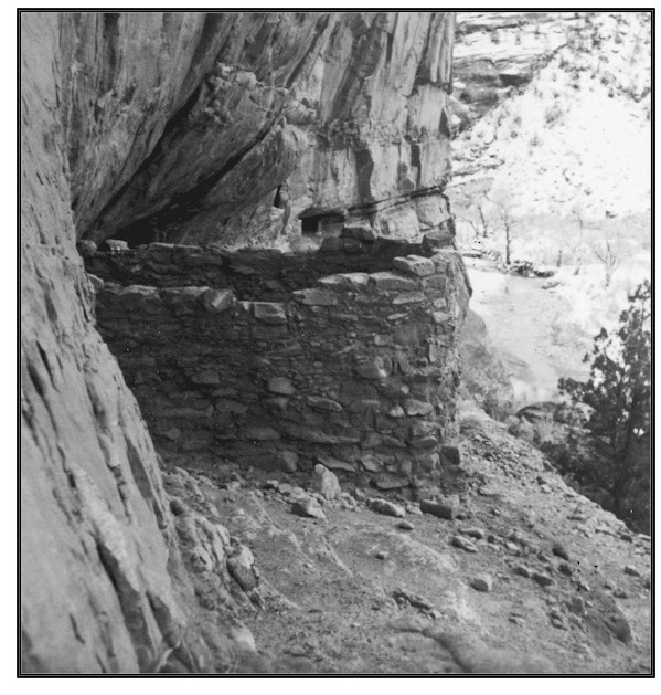
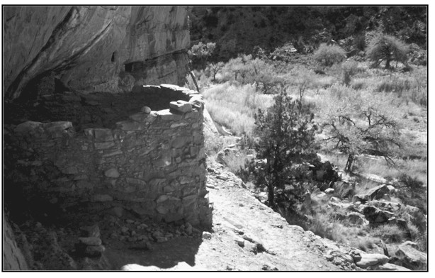
ARCH CANYON 1 This photopoint is in Arch Canyon about 1/2 mile upstream from the fenced private land/BLM land boundary. The view is southeast and downstream across public land administered by the Bureau of Land Management. The 1964 photograph was taken to illustrate a recently stabilized Anasazi structure. However, the photographer did capture a sufficient glimpse of the nearby stream to allow comparison. Although taken during the winter, it is still possible to view the wide, rocky, mostly non-vegetated stream channel that existed in 1964. By 1993 the channel has narrowed, built a new floodplain, and is beginning to reestablish sinuosity. The banks and floodplain are thickly vegetated with riparian species such as Fremont cottonwood, yellow willow, coyote willow, cattail, bulrush, common reed, horsetail, and rush and sedge species. This particular stream segment is in properly functioning condition. The 1993 image was taken prior to livestock removal from the Arch Canyon pasture in 1996.
Photo Information:
Photograph Number: BLM No. 10 Original: Date: 1964 (- A) Photographer: Unknown Source: Bureau of Land Management, Monticello, Utah Retake: Date: November 1993 (- B) Photographer: Earl Hindley Source: Bureau of Land Management, Salt Lake City, Utah
Vegetative Community:
Riparian
Location:
San Juan: NW1/4NW1/4 Section 25 T.37S., R.20E.