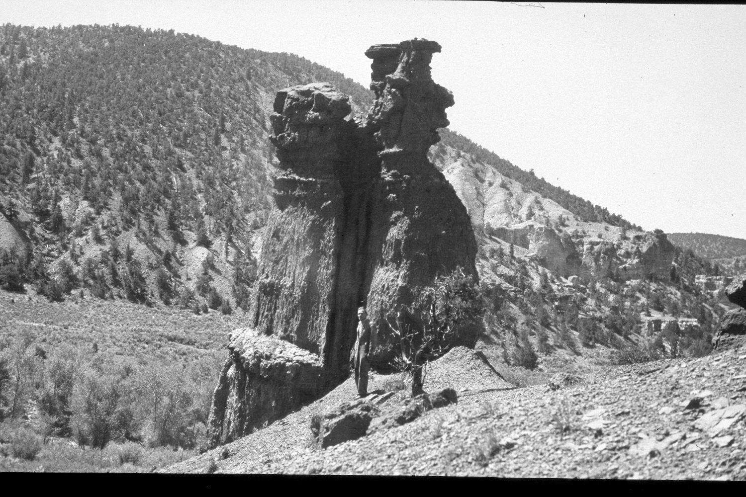
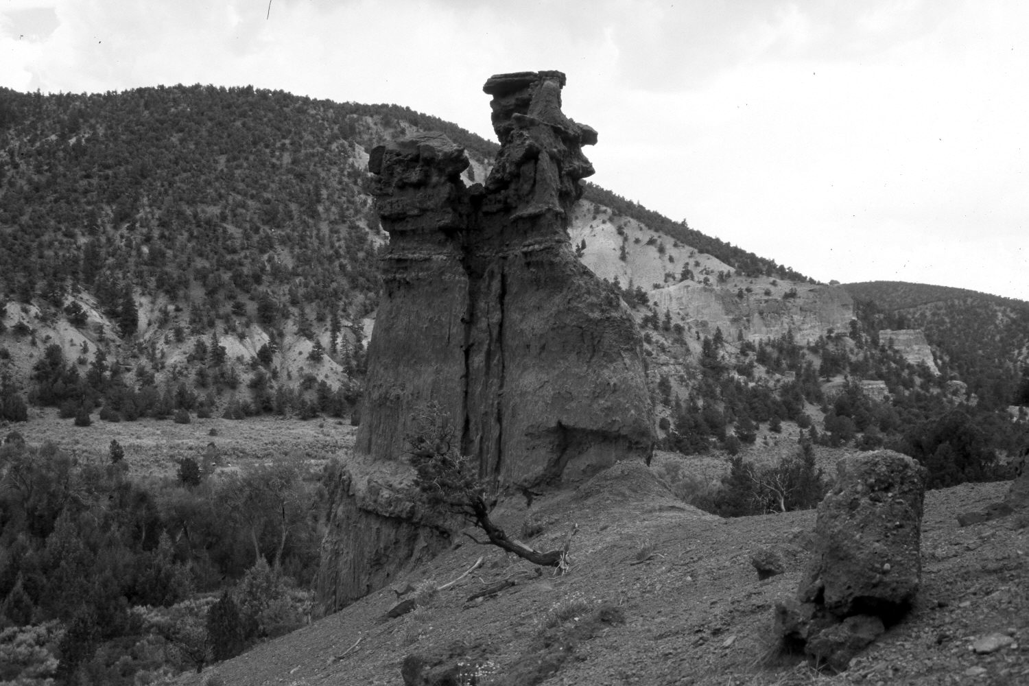
Antimony Canyon
1943
2003
Description:
Plate 210X. Antimony Canyon 1943 - 2003 Viewed south-southwest across Antimony Canyon. Woody riparian vegetation along Antimony Creek appears to have increased, as has pinyon and juniper. The rock formations in the foreground have eroded, especially the hoodoo on the right edge of the photos. Note how the small pinyon to the right of the person in the initial image has eroded and fallen. Livestock are excluded from this section of Antimony Canyon. Sagebrush appears to have increased, especially between the bottom of the rock formation and the stream.
Photo Information:
U.S. Geological photograph taken by H.E. Gregory (No. 1170) in 1943; retake by Charles E. Kay on July 19, 2003 - - Photo No. 5195-7. Original photograph held by U.S. Geological Survey Photographic Library, Denver, CO.
Vegetative Community:
Riparian, Pinyon, Juniper, Sagebrush
Location:
South West: Section 21, Range 1 West, Township 31 South; UTM 420400E, 4217100N; elevation 6,920 ft.