Antimony Bench
1932
2003

Description:
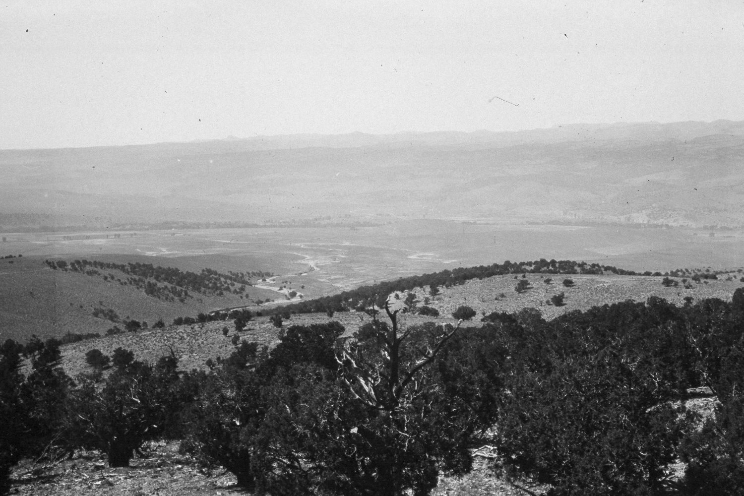
Plate 395X. Antimony Bench 1932- 2003 Viewed southwest down an unnamed draw to the junction of Antimony Creek and the East Fork of the Sevier River. Mount Dutton is in the distance. Pinyon and juniper now block the original photopoint, so the retake was made from the nearest open area. Pinyon and juniper have increased throughout the image, including the lower slopes of Mount Dutton. The original photograph was taken to document the newly deposited erosional debris in the wash. Today, there is considerably less erosion than there was in the past. Woody riparian vegetation appears to have declined along the East fork and Antimony Creek, as additional irrigated hay fields have been developed. There were no signs of livestock grazing on this site, but the area is apparently used by wintering mule deer and elk.
Photo Information:
U.S. Forest Service photograph (272000) taken by Reed Bailey on September 17, 1932; retake by Charles E. Kay on September 1, 2003 - - Photo No. 5279-24A. Original photograph held by the Utah Historical Society, Reed W. Bailey Collection (Box 5), Salt Lake City, UT.
Vegetative Community:
Pinyon, Juniper, Riparian
Location:
South West: Section 7, Range 1 West, Township 31 South; UTM 417750 E, 4219450 N; elevation 7,560 ft.