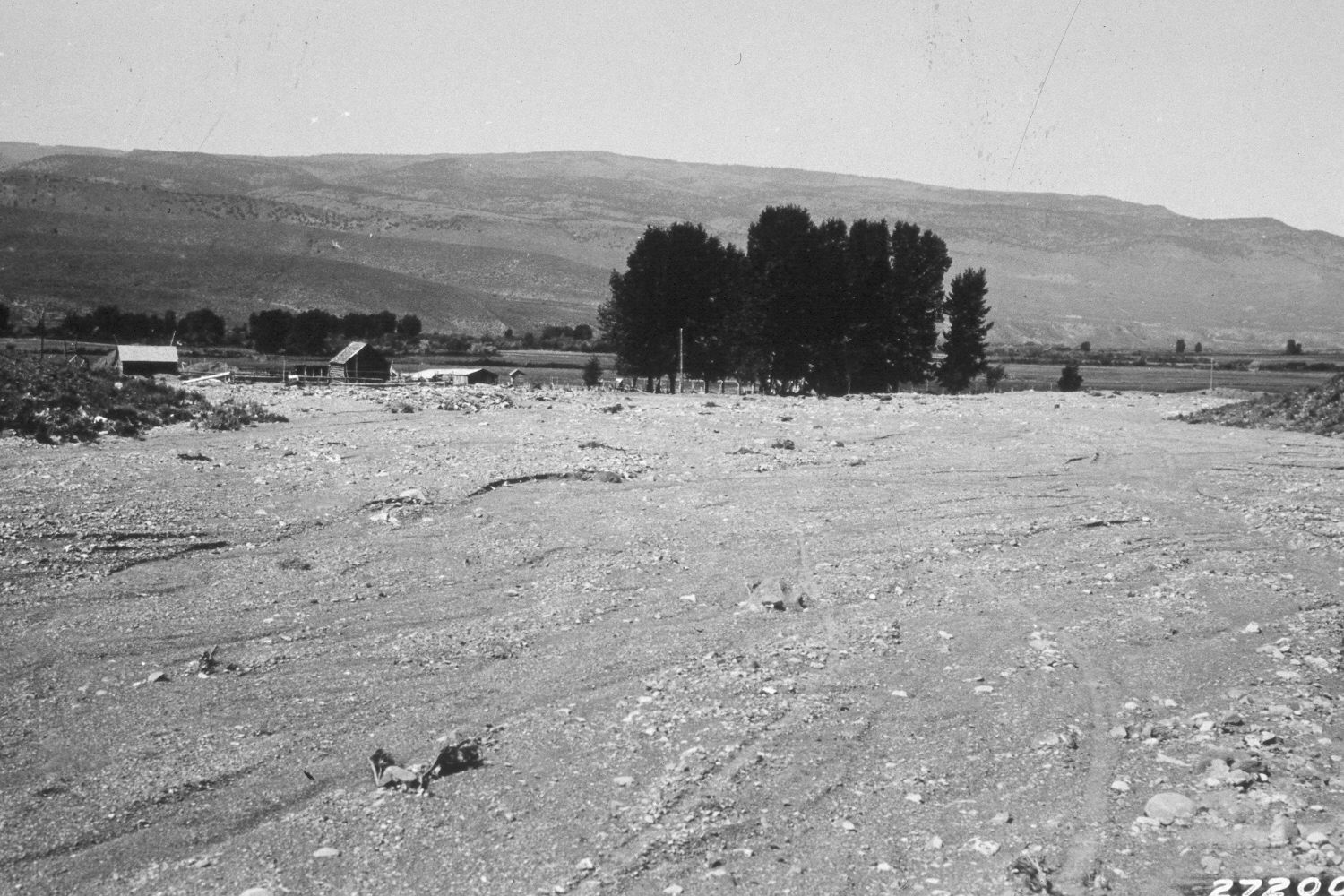
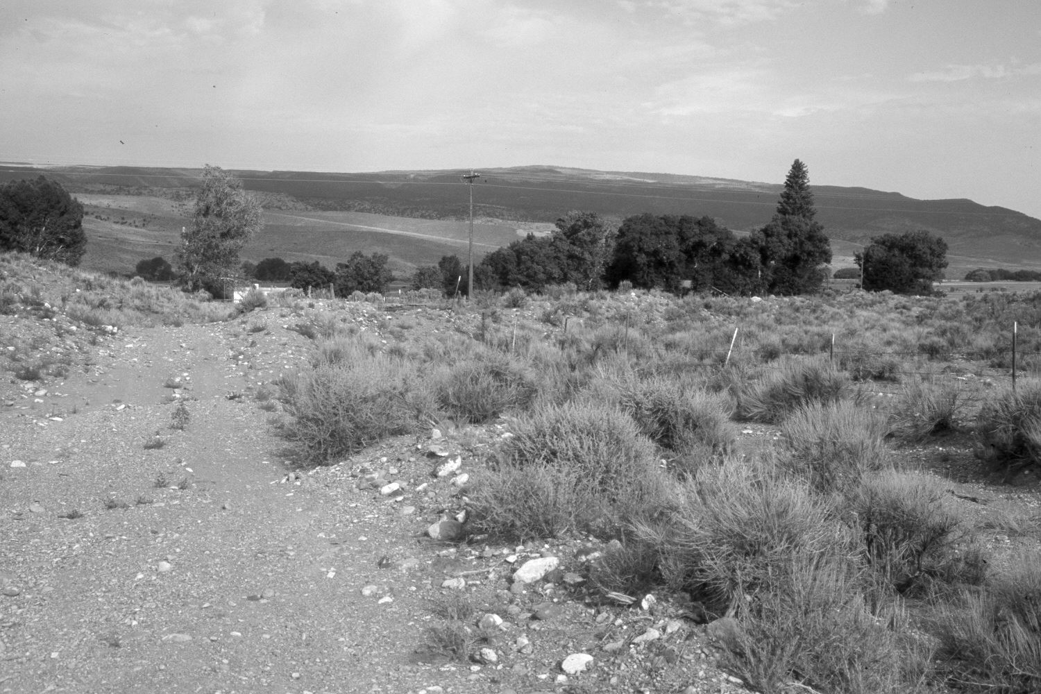
Antimony
1932
2003
Description:
Plate 205X. Antimony 1932 - 2003 Viewed west at the mouth of Kings Hollow one mile south of Antimony, Utah. The original photograph was taken to document the soil and gravel that had eroded from the upper watershed during rainfall events. Today, there is no evidence of soil erosion or recent flood events. Utah Highway 22 is visible in the retake.
Photo Information:
U.S. Forest Service photograph (272002) taken by Reid W. Bailey on September 17, 1932; retake by Charles E. Kay on July 19, 2003 - - Photo No. 5193-19A. Original photograph held by the Utah Historical Society, Reid W. Bailey Collection (Box 5), Salt Lake City, UT.
Vegetative Community:
Sagebrush
Location:
South West: Section 14, Range 2 West, Township 31 South; UTM 413750E, 4217450N; elevation 6,480 ft
January 2018