Antimony
1932
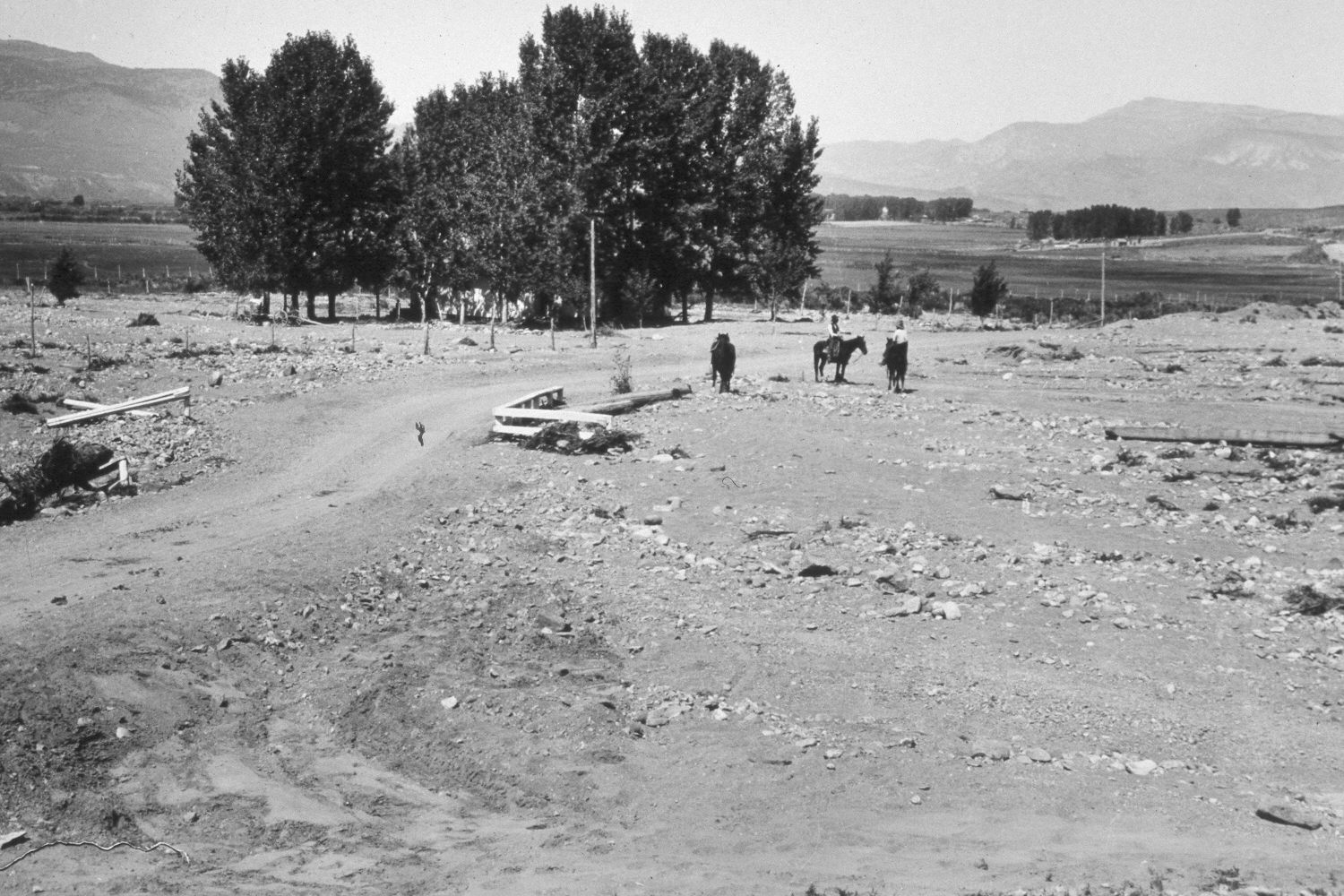
2003
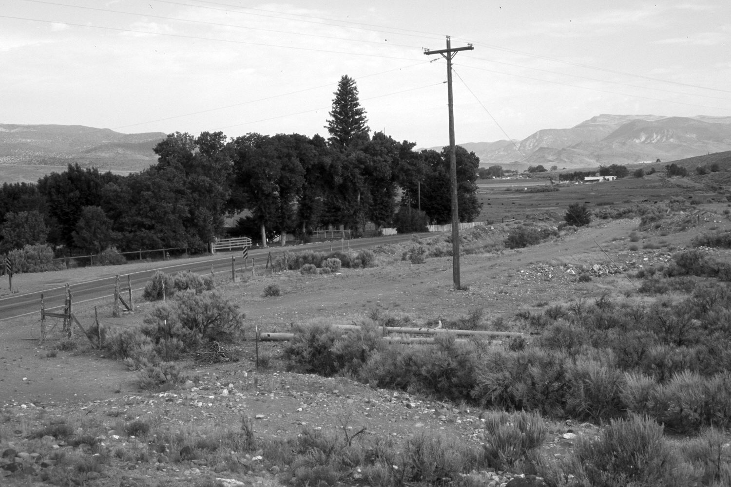
Description:
Plate 204X. Antimony 1932 - 2003 Viewed northwest at the mouth of Kings Hollow one mile south of Antimony, Utah. The original photograph was taken to document the soil and gravel that had eroded from the upper watershed during rainfall events. The roadway was not only flooded, but debris filled-in the eastside irrigation canal for a distance of 3 miles. Today, there is no evidence of soil erosion or recent flood events. Utah Highway 22 is visible in the retake. Sagebrush and four-wing saltbrush (Atriplex canescens) have colonized the gravel outwash.
Photo Information:
U.S. Forest Service photograph (272003) taken by Reid W. Bailey on September 17, 1932; retake by Charles E. Kay on July 19, 2003 - - Photo No. 5193-14A. Original photograph held by the Utah Historical Society, Reid W. Bailey Collection (Box 5), Salt Lake City, UT.
Vegetative Community:
Sagebrush
Location:
South West: Section 14, Range 2 West, Township 31 South; UTM 413750E, 4217450N; elevation 6,480 ft.